Business context
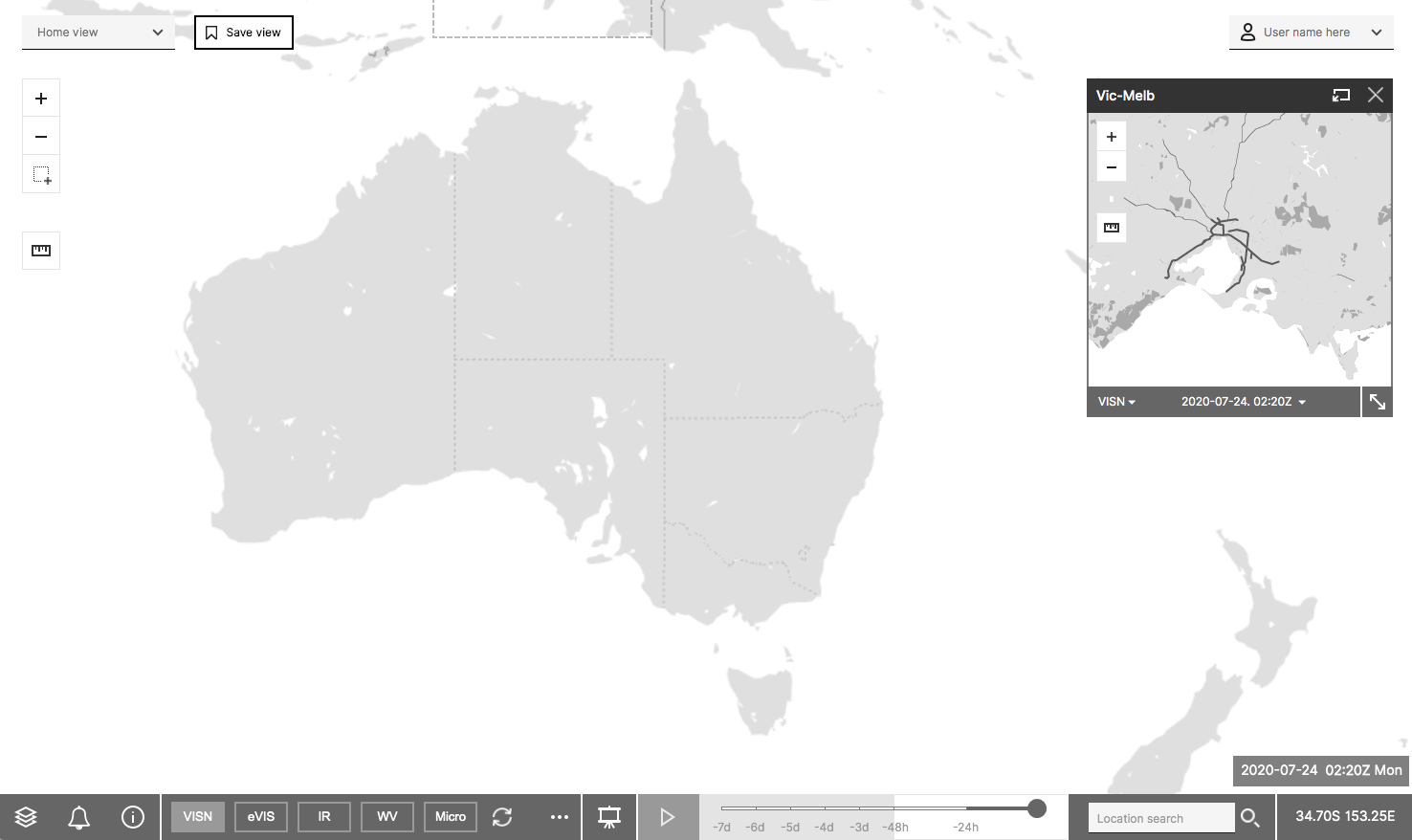
The Bureau requires a graphical/spatial weather monitoring tool that is resilient, secure, accessible and integrated, for use to continuously monitor the environment and historical time series data (up to 10 days prior to the current day) with real time alerting capability based on inputs from Bureau weather forecasting or alerting systems. The current tool is not resilient or scalable and a new tool is required to replace it.
The new tool needs to be web-based so that it can be accessed by staff with the appropriate credentials and basic internet access and it will serve to alert staff so they may inform customers when important weather events are occurring.
Problem statement
How might we design a user interface is best suited for a new graphical/spatial weather monitoring tool that, replacing Panther and in the context of the new RNO framework, will support staff to continuously monitor the environment and historical time series with real time alerting capabilities which are simple and intuitive to use, and easy to learn?
Research method and key activities
- Knowledge review
- Current tool (Panther) user survey
- Contextual interviews
- Co-design workshop
- Prototype test sessions
Project deliverables
Clickable prototype (password: NSAT)
Project timeline (6 weeks)
Start: 22 June 2020
End: 31 July 2020
Overall findings
1. Panther is an essential tool; it reduces the time it takes to get up to speed with the observed weather and is one of the best weather monitoring tools currently available in the Bureau.
2. A wide variety of user groups work with this tool and they have different needs and requirements specific to their role.
3. The success of NSA will be measured against what Panther does well. NSA needs to be as good or perform better than Panther.
4. Extending current features, updating navigation and adding more interactions need to be balanced out with performance and accessibility.
5. Customisation features of saving views, setting alerts and export options will advance NSA over Panther.
Design insights to guide the development of the new tool
- Be respectful of the map. The map brings it all together.
- Support an expert-level user experience. The tool is used many times during a shift.
- Add a user-friendly presentation mode. Decision Support presents to media and customers frequently.
- Be mindful of the different user groups. The structure of features and data sources reflects the needs of user groups.
- Save time with custom settings. Because users investigate the same problem in different ways.
- Adopt a responsive layout. The tool adapts to larger and smaller screen sizes.